

Photographer Retraces William the Conqueror’s Route Across England
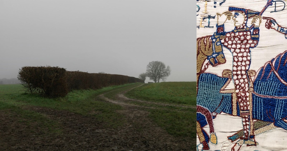
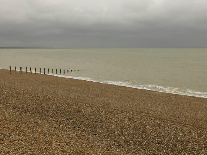 Pevensey Bay, East Sussex, 2026. The shoreline where William the Conqueror landed in September 1066 before beginning his invasion of England © Peter Caton
A photographer has retraced the route that William the Conqueror took across England after the Norman duke landed on the southern coast in 1066.
William’s army defeated and killed the last Anglo-Saxon king of England, Harold Godwinson, at the Battle of Hastings, before William consolidated his power through a series of military campaigns and ultimately claimed the English crown.
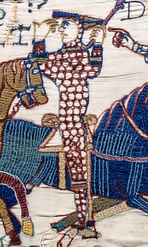 William is depicted in the Bayeux Tapestry during the Battle of Hastings, lifting his helmet to show that he is still alive.
In a new photo book, Peter Caton traces William the Conqueror’s route across England, from his landing at Pevensey Bay to the aftermath of the Harrying of the North, asking what remains of the Norman Conquest in the landscape nearly a thousand years later.
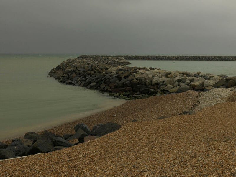 Pevensey Bay, East Sussex, 2026. Modern coastal defences reshape the shoreline where William the Conqueror came ashore in September 1066 © Peter Caton
Most of the places along that route appear entirely unremarkable today, and it is this contrast between their everyday appearance and the extraordinary events they once witnessed that lies at the heart of the work.
The journey moves through the reshaped coastline at Pevensey Bay, the quiet ground below the ridge at Battle, the river crossing at Wallingford, the earthworks folded into farmland at Berkhamsted, the drained marshland at Ely, and the recovered farmland of Yorkshire, once devastated by the Harrying of the North.
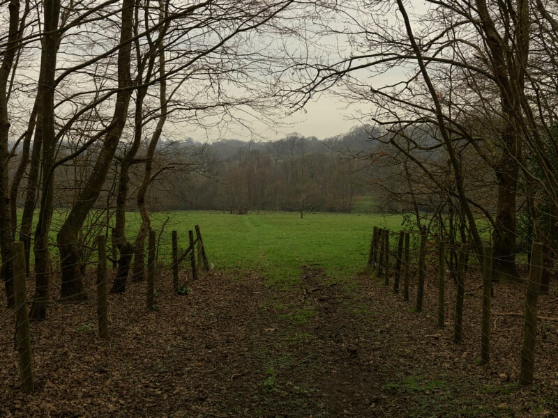 Battle, East Sussex, 2026. The landscape surrounding the battlefield where the Norman Conquest of England was decided © Peter Caton
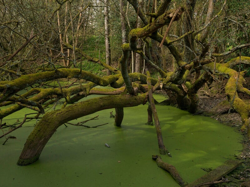 Battle, East Sussex, 2026. Wet woodland within the landscape where retreating Anglo-Saxon forces were pursued and cut down following the Battle of Hastings in 1066 © Peter Caton
The photographs themselves are deliberately quiet and observational, avoiding dramatic light or overt historical symbolism in favour of a restrained, objective view that gives space for reflection.
“After 1066 began with a simple question: nearly a thousand years after the Norman Conquest, what can still be seen in the landscape?” says Caton. “I was surprised by how ordinary these places were. Rather than trying to recreate history, I wanted to photograph the landscapes as they exist today and encourage people to look more carefully at places that have quietly shaped England’s history.”
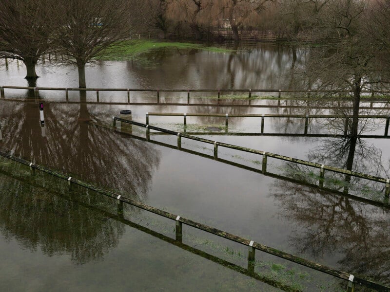 Wallingford, Oxfordshire, 2026. Flooded land beside the River Thames, where William secured an important crossing during his advance towards London © Peter Caton
The book includes an introductory essay by Tracy Marshall-Grant, who places Caton’s work within a tradition of landscape photographers exploring the relationship between land, memory and history. She writes that his photographs ask us to see landscape not as “simply backdrops to history but living witnesses to it.”
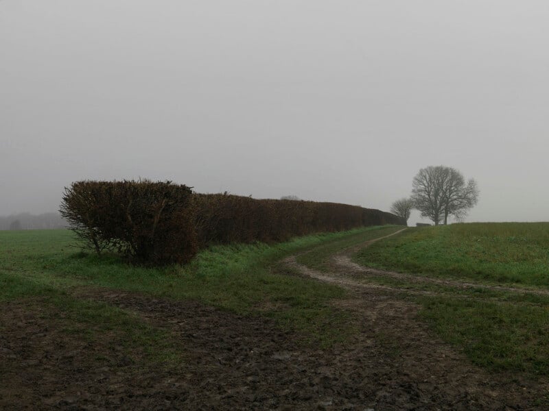 Berkhamsted, Hertfordshire, 2026. A muddy track leads towards the landscape surrounding Berkhamsted Castle, where the submission of the English nobility secured William’s claim to the English throne © Peter Caton
The project’s publication is timed to coincide with the Bayeux Tapestry’s return to Britain in September 2026, its first visit to the U.K. in almost 1,000 years, and comes ahead of the millennium of William the Conqueror’s birth in 2027.
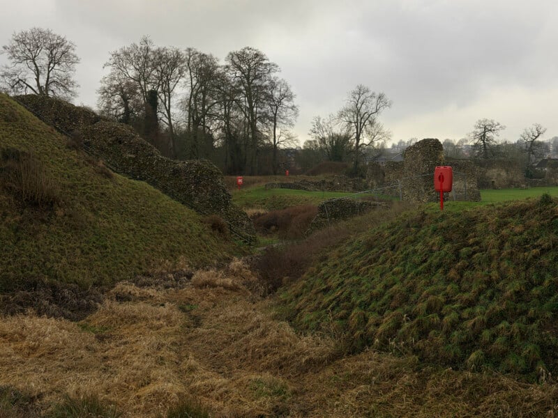 Berkhamsted Castle, Hertfordshire, 2026. The earthworks of Berkhamsted Castle, where the leading English nobles submitted to William the Conqueror in December 1066 © Peter Caton
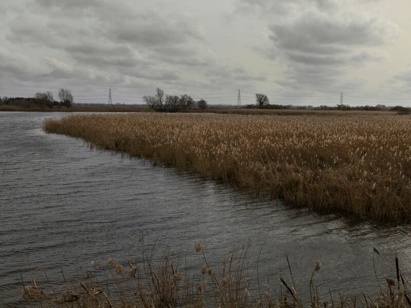 Ely, Cambridgeshire, 2026. Reedbeds and waterways within the Fens, where marshland once formed one of the last refuges of English resistance after the Norman Conquest © Peter Caton
Peter Caton is an internationally recognised documentary photographer whose work explores humanitarian issues and the impact of climate change on communities worldwide. Over more than two decades working across Asia, Africa and South America, he has been commissioned by organisations including Greenpeace, Save the Children, WWF, UNHCR, Oxfam and the Red Cross, and published by The Sunday Times Magazine, The Guardian, The Washington Post, Marie Claire, Esquire, and Le Figaro.
After 1066: Photographs of an English landscape is published by RRB Photobooks.
Image creditsFrom After 1066: Photographs of an English Landscape 2026 © Peter Caton
Affiliate Disclosure PetaPixel articles may include affiliate links; we may earn a commission if you buy through one.
What's Your Reaction?
 Like
0
Like
0
 Dislike
0
Dislike
0
 Love
0
Love
0
 Funny
0
Funny
0
 Wow
0
Wow
0
 Sad
0
Sad
0
 Angry
0
Angry
0







Comments (0)