

Amazing High-Res Photo Shows a Butte Rising From Mars
Trundling around on an alien planet some 140 million miles from Earth is the solar system’s most intrepid landscape photographer, snapping awe-inspiring shots as it scrambles up a mountain that’s inside a crater.
NASA’s Curiosity Rover doesn’t get the praise it deserves, primarily because it is a robot. But every now and then, it is worth pausing to marvel at the imagery this plucky rover is capable of capturing.
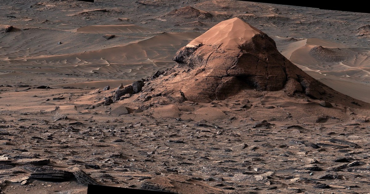
Case in point is this image that Curiosity captured on the 4,923rd Martian day, or sol. On Earth, it was June 11, 2026.
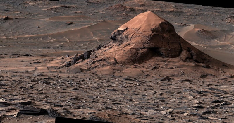
Curiosity captured 11 individual photos with its Mast Camera of a sand-capped butte, nicknamed “Miraflores.” The isolated hill is estimated to be roughly 20 feet (6 meters) tall. The butte was left behind as surrounding rock eroded away over time, deepening the broad valley Curiosity is climbing through.
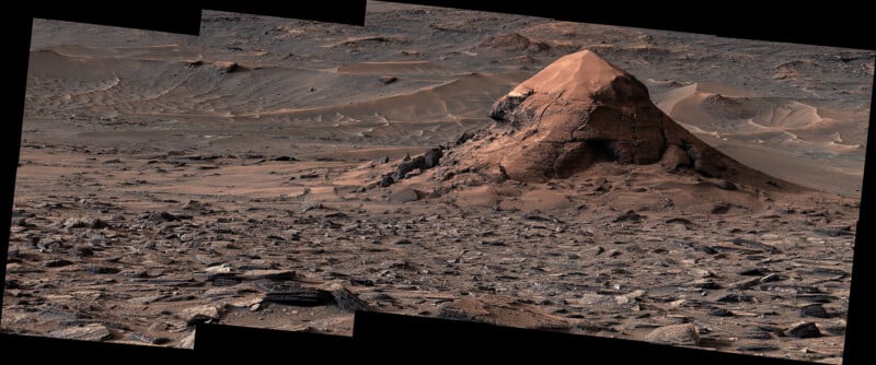
Those 11 photos were sent back to Earth and stitched together. As is often the case with panoramas, NASA scientists weren’t quite able to fill the frame perfectly with the image data, but nevertheless produced a high-resolution panoramic (6,162 x 2,576 pixels) that can be zoomed in on to reveal outstanding details.
The color was adjusted to match the lighting conditions as the human eye would see it if a person were standing on the surface of the Red Planet.
The butte is surrounded by thousands of Martian polygons on the floor, which is thought to be an ancient seabed. These honeycomb-like textures are each about 1.5 to 3 inches (4 to 8 centimeters) across.
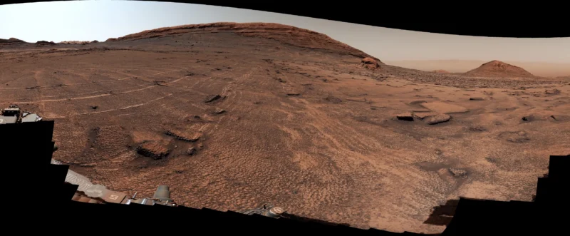 The photo of the sea ofo polygons was taken on the same day, June 11, not far from the butte.
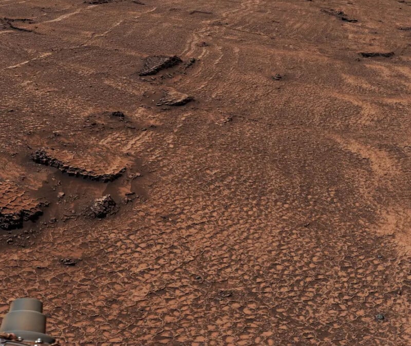 The polygonal shapes spread in all directions for as far as the rover can see. They even wrap around the sides of the nearby butte nicknamed Miraflores.
“We’ve seen a lot of fascinating landscapes through Curiosity’s eyes, but this sea of polygons took our breath away,” says the mission’s project scientist, Ashwin Vasavada of NASA’s Jet Propulsion Laboratory in Southern California. “We measured their shapes and chemistry carefully and are hopeful there are clues in the data as to how these features formed.”
The butte and the polygons are both inside the 96-mile-wide Gale Crater, in which sits Mount Sharp, an 18,000-foot-high central peak that rises from the crater.
“Billions of years ago, lakes and streams dappled the lower foothills of Mount Sharp, a 3-mile-tall (5-kilometer-tall) mountain that Curiosity has been ascending since 2014,” NASA explains.
“The rover has previously uncovered chemistry left over from Mars’ watery history, including carbon-based molecules believed to be precursors to RNA and DNA, two nucleic acids that carry genetic information. Scientists have no way of knowing whether these organic molecules were created by biologic or geologic processes — either path is possible — but their discovery reconfirmed that ancient Mars had the right chemistry to support life.”
Affiliate Disclosure PetaPixel articles may include affiliate links; we may earn a commission if you buy through one.
What's Your Reaction?
 Like
0
Like
0
 Dislike
0
Dislike
0
 Love
0
Love
0
 Funny
0
Funny
0
 Wow
0
Wow
0
 Sad
0
Sad
0
 Angry
0
Angry
0










Comments (0)